Cehu Silvaniei (Comuna Cehu Silvaniei)
Cehu Silvaniei (Szilágycseh, until 1854 Szilágy-Cseh, meaning "Czechs of Szilágy") is a town in Sălaj County, Crișana, Romania. Four villages are administered by the town: Horoatu Cehului (Oláhhorvát), Motiș (Mutos), Nadiș (Szilágynádasd) and Ulciug (Völcsök).
The first written mention of the town dates from 1319 under the name Cheevar. In 1405, the city was mentioned under the name Chehy. The Hungarian name of the city referred to a stand of Czech origin.
The town was until 1918 part of the Kingdom of Hungary and specifically of the Principality of Transylvania. In 1529, the voivod István Báthory granted the city the right to govern itself.
After the dissolution of the principality of Transylvania in 1867 and its direct integration into the Austro-Hungarian Empire as part of Hungary (see the Austro-Hungarian Compromise of 1867), the city is attached to Szilágy County in 1876. In 1918, during the disintegration of the empire at the end of World War I, the city became part of the Kingdom of Romania.
From 1940 to 1944 it was annexed by Hungary as a result of the Second Vienna Award. In May 1944, its Jewish community was exterminated by the Nazis during several deportations to Auschwitz.
At the end of World War II, the city was incorporated into Romania again.
The city has long been an agricultural center. In 1968, during the country's administrative reorganization, it acquired city status and then industrialization take place (textiles, furniture).
Map - Cehu Silvaniei (Comuna Cehu Silvaniei)
Map
Country - Romania
 |
 |
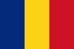
| Flag of Romania | |
Europe's second-longest river, the Danube, rises in Germany's Black Forest and flows southeasterly for 2857 km, before emptying into Romania's Danube Delta. The Carpathian Mountains cross Romania from the north to the southwest and include Moldoveanu Peak, at an altitude of 2544 m.
Currency / Language
| ISO | Currency | Symbol | Significant figures |
|---|---|---|---|
| RON | Romanian leu | lei | 2 |
| ISO | Language |
|---|---|
| HU | Hungarian language |
| RO | Romanian language |


